TL;DR: Dade County EMA will open all three community shelter facilities from 6:00 p.m. Friday, October 9 to 6:00 p.m. Monday, October 12 as Hurricane Isaias approaches the Gulf Coast.
Dade County opens three shelters for Isaias forecast
Dade County Emergency Management will open all three community shelter facilities to the public because of the forecast for Hurricane Isaias, according to WDEF.
The facilities open Friday, October 9 at 6:00 p.m. and close Monday, October 12 at 6:00 p.m., according to WDEF. The agency said the locations will operate 24 hours a day during that window for anyone needing a safe place to stay.
The announcement was reported by McKenzie Hughes for WDEF on October 9. Dade County is in northwest Georgia, inland from the Gulf Coast, but officials positioned the shelters ahead of expected heavy rain and inland effects forecast to extend into the weekend as far as the Tennessee Valley.
Forecasters expected Isaias to make landfall on the northern Gulf Coast late Friday or early Saturday, with strong winds, life-threatening storm surge, flooding and possible tornadoes, according to NBC 6 South Florida. By Thursday evening, the National Hurricane Center in Miami described Isaias as a Category 2 storm with maximum sustained winds around 105 mph, moving northeast at 14 mph and centered about 260 miles south of the mouth of the Mississippi River.
By Friday morning, the National Hurricane Center said Isaias had become a Category 3 hurricane with maximum sustained winds of 120 mph, located about 240 miles south of Pensacola and moving north-northeast at 15 mph, according to CBS12. Forecasters expected the center to approach the northern Gulf Coast Friday afternoon, with landfall Friday night or early Saturday.
Shelter hours and round-the-clock access
The Dade County shelters will remain available around the clock from Friday evening through Monday evening, according to WDEF. That continuous schedule covers three full overnight periods.
Anyone who needs shelter can use the facilities during the open period. The county did not list separate general-population, medical or pet-specific sites in the WDEF report, describing all three locations as community shelter facilities open to the public.
Residents with questions were directed to call Dade County E911/EMA at 706-657-4111, identified as the non-emergency line, according to WDEF.
The county also urged residents to stay informed about changing weather conditions, follow official safety guidance, and check on family members, friends and neighbors who may need assistance.
What the facilities provide and what to bring
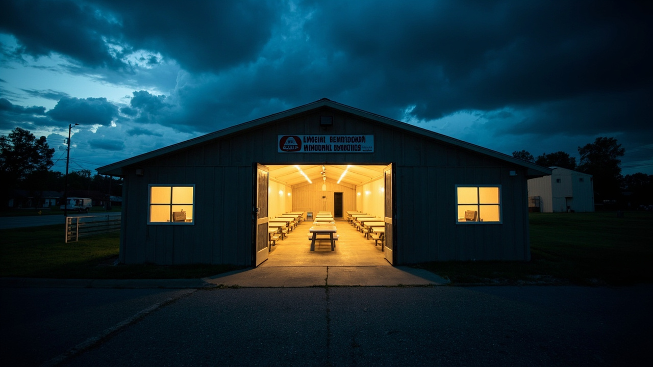
Tables and chairs will be available inside the Dade County facilities, according to WDEF. The facilities are monitored by cameras to help determine when people are present and promote safety.
People planning an extended stay should bring necessary personal supplies, including food, water, medications and other essential items, according to WDEF. The notice framed personal supplies as the visitor’s responsibility for longer stays, rather than a service supplied at the shelter.
The guidance aligns with shelter advice issued elsewhere before Isaias. In Mobile County, Alabama, officials recommended prescription medications and essential medical supplies, baby formula, diapers and special dietary items, food, water and personal necessities for up to 72 hours, bedding, blankets, pillows, personal hygiene items and cleaning items, although those Mobile County details were separate from the Dade County notice.
Why inland counties opened shelters
Isaias surged toward the U.S. Gulf Coast on Thursday as the first hurricane of the Atlantic season, prompting mandatory evacuations, school closures and local government shutdowns in parts of Florida, according to NBC 6 South Florida.
The storm was forecast to intensify rapidly and bring strong winds and life-threatening storm surge to the Florida Panhandle, southern Alabama and southern Mississippi at landfall, according to NBC 6 South Florida. Heavy rain with flood risk was possible into the weekend as far inland as the Tennessee Valley.
The National Hurricane Center said Thursday, “Preparations to protect life and property from storm surge and damaging winds along the warning area of the Gulf Coast should be rushed to completion today.”
Water from storm surge combined with high tide could reach 5 to 7 feet in parts of Alabama and Mississippi, according to NBC 6 South Florida. The storm could also drop up to 10 inches of rain along parts of the Gulf Coast and spawn tornadoes Friday night into Saturday from Alabama to the Florida Panhandle to southwestern Georgia. The hurricane was expected to weaken quickly after landfall.
The National Weather Service told communities from Ocean Springs, Mississippi, to Gulf County, Florida, to prepare for the possibility of long-duration power outages, according to NBC 6 South Florida.
Warnings, surge outlook and evacuation zones
A hurricane warning covered the Florida coast from the Bay-Gulf county line westward, while a storm-surge warning stretched from the mouth of the Mississippi River to the Suwannee River, according to CBS12.
The National Hurricane Center warned of 5 to 7 feet of storm surge from Dauphin Island, Alabama, to Indian Pass, Florida, and 4 to 6 feet from Indian Pass to the Steinhatchee River, according to CBS12.
Across the Panhandle, counties opened shelters and ordered evacuations in vulnerable coastal areas, according to CBS12. Escambia, Santa Rosa and Okaloosa counties ordered evacuations for Zones A and B and certain low-lying and mobile-home areas. Bay County issued a voluntary evacuation for Zones A and B and residents of mobile or manufactured homes. Franklin County ordered evacuations for barrier islands, low-lying areas, mobile homes and RV parks.
Florida Gov. Ron DeSantis said the state was preparing for a major-hurricane landfall despite forecasts calling for some weakening before landfall, according to CBS12. “We are planning to assume that [weakening] will not happen and that it will make landfall as a major hurricane,” he said.
DeSantis urged residents in evacuation zones to leave and warned that storm surge poses the greatest threat to life, according to CBS12.
Other shelters open across the Southeast
In Escambia County, Florida, officials opened a general-population shelter at Pensacola Bay Center and a special-needs shelter at the Marie K. Young-Wedgewood Community Center, according to CBS12. Santa Rosa County opened a pet-friendly shelter at the Clyde L. Gracey Community Center in Milton. Okaloosa County opened shelters at Davidson Middle School in Crestview and Raider Arena at Northwest Florida State College in Niceville.
At least four Florida school districts canceled classes for later in the week, while Okaloosa County announced mandatory evacuations for some coastal areas, according to NBC 6 South Florida. Governors in Florida and Alabama declared a state of emergency for dozens of counties.
Florida’s emergency order covered 27 counties as of Friday, according to CBS12. The state’s Hurricane Isaias information page included links to active evacuation orders, shelters and emergency resources.
Air travel and base operations were also curtailed. Pensacola International Airport said its terminal would close to commercial operations at 10 a.m. Friday, while Destin-Fort Walton Beach Airport closed Thursday night until further notice, according to CBS12. NAS Pensacola moved to HURCON 1, limiting reporting to mission-essential personnel.
State crews, Guard and search teams staged
Florida officials said more than 6,000 utility workers were on standby, nearly 400 Florida State Guard soldiers had deployed, and about 5,000 Florida National Guard members were expected to be mobilized, according to CBS12. At least two South Florida urban search-and-rescue teams staged in Tallahassee, while the Florida Highway Patrol had more than 300 quick-response troopers ready. The state also authorized 242 temporary debris-management sites.
Gov. DeSantis spoke Friday morning with Florida Division of Emergency Management Executive Director Jared Perdue as Isaias moved toward the coast, according to CBS12.
Additional teams from South Florida prepared to move north. Florida Task Force 2, an 80-member team from City of Miami Fire Rescue Urban Search and Rescue, was set to deploy Thursday morning to the Panhandle with a swift-water rescue component, search specialists, rescue K-9s, doctors, structural engineers and radio communications specialists, prepared to be self-sustained for two weeks, according to NBC 6 South Florida. Miami-Dade Fire Chief Brandon Webb said teams deploy with medical staff and a base camp that houses personnel so they can move into an affected area without burdening the affected agency.
DeSantis told residents to assume outages and service interruptions, according to CBS12. State officials urged residents in evacuation and warning areas to finish preparations quickly.
Late-season storm and energy impacts
Isaias developed more than four months into the Atlantic hurricane season and fell one day short of tying a 121-year-old record for the latest-forming first Atlantic hurricane, according to NBC 6 South Florida. The record dates to 1905, when the year’s first Atlantic hurricane formed on Oct. 8.
The Atlantic season had been unusually quiet because of a strong El Niño, which disrupts storm formation over that ocean, according to NBC 6 South Florida. Storm activity had been above average in the Pacific, where Tropical Storm Simon formed Wednesday off Mexico.
Ahead of Isaias, oil and gas producers shut down a significant share of offshore production in the Gulf, which accounts for almost 15% of crude pumped annually in the United States, according to NBC 6 South Florida. As of Wednesday, about 25% of regional oil production was temporarily halted, removing about 511,000 barrels a day from the market, according to the Marine Minerals Administration. The agency said eight of the Gulf’s 371 manned oil platforms were evacuated.
Jim Burkhard, global head of crude oil market research for S&P Global Energy, said the cuts were steep enough to affect markets, though other Gulf hurricanes had caused larger disruptions, according to NBC 6 South Florida.
What Dade County residents should do next
Residents who lack a safe structure, expect power loss, or may need help during high winds and heavy rain can use the Dade County shelters at any hour while they are open, according to WDEF. Visitors staying an extended period should arrive with food, water, medications and essential items.
Check forecasts, follow official safety guidance, check on relatives and neighbors who may need assistance, and use the non-emergency number 706-657-4111 for shelter questions, according to WDEF.
Sources referenced
- Dade Co. EMA to open three community shelter facilities due to Hurricane Isaias - WDEF (https://www.wdef.com/dade-co-ema-to-open-three-community-shelter-facilities-due-to-hurricane-isaias/)
- Florida prepares for Category 3 Isaias: Evacuations ordered, shelters open, crews deployed - CBS12 (https://cbs12.com/weather/hurricane-stories/florida-mobilizes-as-hurricane-isaias-reaches-category-3-strength-230-mph-panhandle-gulf-guard-members-search-rescue-northern-gulf-coast-utility-workers-emergency-order-27-counties-gov-desantis)